Geography lessons have one recurring problem: the world stays abstract. Capitals and coastlines on a worksheet are somebody else's facts. The moment the map is about the class itself, the same material becomes personal, and personal is what sticks.
One map the whole class builds
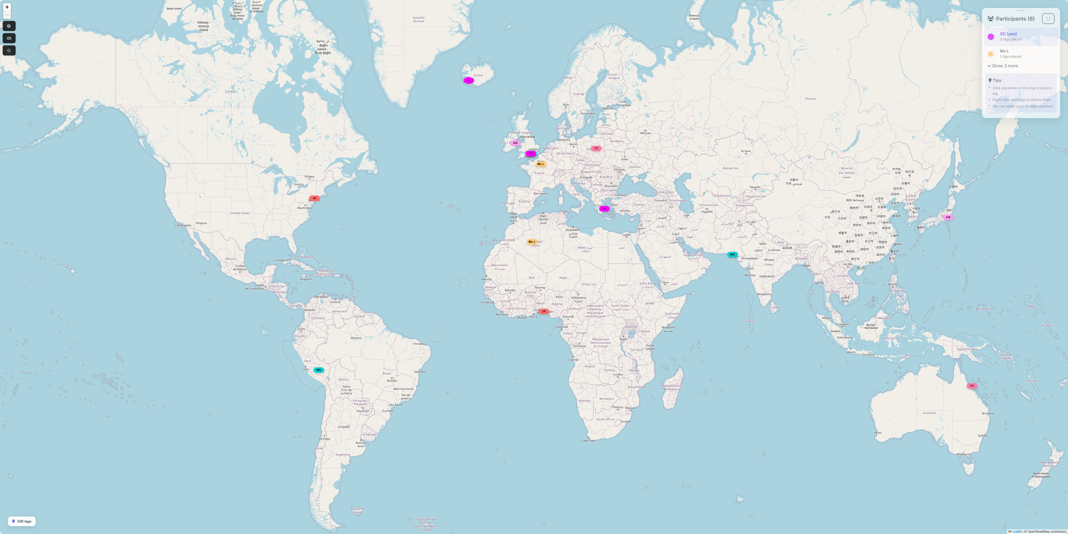
Tag The Map gives a class a shared world map that everyone pins together, live. The teacher hosts and puts the map on the board; students join from any browser with a short code. There is nothing to install, and students do not create accounts: they join with the session code and a display name, so a first-names-or-initials rule is easy to apply.
Activity ideas by topic
- Where has this class been? The opener. Everyone pins places they have visited or lived, then the class reads its own map: continents covered, hemispheres, the nearest and furthest pins, the group's country count.
- Family roots. Pin the places your family comes from. It reliably produces a wider, richer map than the travel one, and every pin has a story a student is the expert on.
- Scale and distance. Zoom from a single pin to street level, then out to the whole world. Which pin is furthest from the school? How would you even work that out?
- What counts as a country? The class map counts countries using the ISO 3166-1 list over Natural Earth boundaries, which contains 250 entries rather than the familiar 195. Why is Greenland its own entry? Why does a pin in Guam not count as the United States? There is a whole lesson in how the counting works, and it is a genuinely honest introduction to how messy "how many countries are there?" really is.
- Dream destinations. Pin somewhere you want to go and be ready to say why. Equal footing for every student, whatever their travel history.
Why teachers find it easy to run
- Low friction: one code on the board and the class is in, on laptops, tablets or phones.
- Privacy by default: no student accounts, no sign-ups, and display names are whatever the class agrees. Participants are anonymous beyond the name they choose.
- Control stays with the host: the teacher can close the map to new pins when the activity ends, while keeping it viewable for discussion or a follow-up lesson.
- It differentiates itself: confident students narrate their pins; quieter students contribute fully without saying a word.
A note on younger groups
The activity works from the age a student can use a web map, but the framing matters more than the mechanics: agree the naming rule up front, keep prompts about places rather than personal circumstances, and treat "I have not travelled" as a non-issue by mixing in the roots and dream-destination prompts, where everyone has pins to add.
Bring your classroom's world into the room
Host the session, put the code on the board, and let the class do the geography.
Host a session How we count countries